The Surface Water Division of the Nebraska Department of Water, Energy, and Environment (DWEE) is responsible for the stewardship of the state’s natural streams and lakes, which the State Constitution dedicates to public use and protection. The division manages a rigorous permitting and adjudication system that grants specific rights for water diversion and impoundment, primarily for irrigation, a recognized "natural want" in Nebraska. By administering these rights based on a priority system, the DWEE ensures that water is used for its most beneficial purpose, protecting senior permit holders during natural shortages while allowing for new uses when resources are available.
Beyond resource allocation, the division operates extensive water quality monitoring and assessment programs to protect public health and the environment. This includes a six-year basin rotation strategy to identify pollution, weekly testing of over 50 public beaches for toxins like E. coli, and fish tissue sampling to provide consumption advisories. These efforts are supported by a network of 101 fixed ambient monitoring stations that track chemical and physical water parameters, ensuring that Nebraska's river basins support aquatic life, recreation, and safe drinking water supplies.
The division’s technical foundation rests on a robust streamgaging program and a community-driven climate network. Operating more than 250 gaging sites, the DWEE collects vital hydrological data used for flood modeling, groundwater studies, and interstate compact compliance. This professional oversight is supplemented by the Nebraska Rainfall Assessment and Information Network (NeRAIN), a citizen-science initiative where hundreds of volunteers contribute localized precipitation data. Together, these programs provide the comprehensive data necessary for informed decision-making regarding the state's current and future water demands.
Surface Water Quality Monitoring
The Surface Water Monitoring and Assessment programs collect physical, chemical, and biological water quality samples from streams and lakes, implements surface water improvement projects, and prepare surface water quality reports through many different programs.
Basin Rotation Monitoring Program
Targeting specific areas in the state each year improves DWEE's ability to identify and remediate water quality problems and allows resources to be focused where they can produce the greatest environmental results. During a six-year cycle, all 13 river basins in the state are intensively monitored. Monitoring data are used to document existing water quality conditions, assess the support of beneficial uses (such as aquatic life, recreation, and public drinking water supply), and prioritize water quality problems.
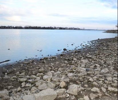
Public Beach Monitoring Program
Monitors public lakes with designated swimming beaches and/or a large amount of water based recreation. E. coli bacteria and toxic blue-green algae (microcystin toxin) are monitored weekly from May through September. Currently, 56 beaches on 51 different lakes are monitored with approximately 1200 samples assessed annually for each parameter. The ingestion of E. coli and/or the microcystin toxin can lead to serious illness in humans and may be fatal to pets.
Fish Tissue Monitoring Program
Each year fish samples are collected from numerous streams and lakes across Nebraska to determine their suitability for human consumption. This is important because certain contaminants have a tendency to bio-accumulate in fish tissue and, when eaten, can cause an increased risk for human health problems. In waterbodies where contaminant levels in fish are of concern, “fish consumption advisories” are issued. These advisories do not ban the consumption of fish from a particular waterbody. Rather, advisories are designed to inform the public of how to safely prepare and eat what they catch, and provide suggested guidelines for limiting consumption. As a food source, fish are a high quality protein, low in saturated fat, and high omega-3 fatty acid food source, so anglers should not be discouraged from consuming fish in moderation.
Stream Biological Monitoring Program
This program is used to evaluate the health of aquatic life populations and involves a unique randomized sample design that allows water quality status and trend assessments to be determined with a known level of confidence. Sampling is conducted in conjunction with the basin rotation monitoring strategy.
Ambient Stream Monitoring Program
This program has a network of 101 fixed stations located on main stem and tributary streams across the state, including six stations on the Missouri River. The program’s primary objectives are to provide information on the status and trends of water quality in streams within each of the state's 13 river basins and link assessments of status and trends with natural and human factors that affect water quality. Ecoregion and land use considerations were used in selecting many of the stream locations. A representative number of State Resource Waters as well as streams within major urban areas were also selected. Samples are collected monthly and analyzed for traditional chemical and physical parameters and include nutrients, select herbicides and heavy metals.
Surface Water Permits & Adjudication

People who use Nebraska’s surface water resources are required in most instances to obtain a surface water permit from the Nebraska Department of Water, Energy, and Environment (DWEE). The permit(s)/water right(s) are approved for a specific location and purpose.
A surface water permit/right allows the appropriator (in most cases, the landowner) the right to divert water at a set rate, for a certain amount, from an approved point of diversion, to irrigate a certain area of land. Permits are also granted for the right to impound a specified volume of water in a reservoir. Holders of water rights must use the water for the purpose legally allowed under the permit. Failure to use the water can result in DWEE canceling the permit.
Surface Water Administration
The DWEE administers surface water appropriations in accordance with the priority and limitations of the rights granted. To fulfill this duty, DWEE has field offices located across the state.
Administration of water rights is necessary to ensure that all water is being used to the most beneficial use allowed under Nebraska law. Proper administration allows for new permits to be granted for new uses when water is available. Holding all permits to the amount of the appropriation assures junior permit holders that they will be allowed to divert water until a natural shortage occurs. During times of shortage, junior (new priority) permits must be denied water so that senior (old priority) permits may receive the full amount of their permits.
Streamgaging
The Department of Water, Energy, and Environment is authorized to measure and monitor the water flowing in Nebraska’s streams, rivers, and canals. For this purpose, the Department has established a Streamgaging Program. Through this program, the Department operates and maintains a streamgaging network comprised of more than 250 gaging sites. The network includes continuous stream and reservoir gages, partial year gages, canal gages, canal return flow gages, and miscellaneous spot measurements. The core network consists of approximately 110 continuous streamgages and 120 canal gages.
Activities within the Streamgaging Program are primarily carried out by the Streamgaging Section and the Department's five field offices. The Streamgaging Section is responsible for the overall administration and coordination of the Streamgaging Program. This includes overseeing data collection, managing hydrological data, publishing streamgaging records, disseminating data, and ensuring quality control standards are met. The field offices are primarily responsible for making streamgaging measurements, for operating and maintaining streamgaging stations and equipment, and for assisting with processing and reviewing the data collected within their jurisdictional area.
The Department uses the data collected from streamgaging stations and measurement sites to make informed decisions regarding the wise and proper use of Nebraska’s water resources. This includes administering water rights, issuing permits, studying surface water/groundwater interactions, modeling floodplains, quantifying water supplies and uses, calibrating groundwater models, complying with interstate compacts, and planning for future water demands.
NeRAIN
The Nebraska Rainfall Assessment and Information Network (NeRAIN) is a program designed to get citizens involved with monitoring weather across the state. The network consists of several hundred volunteers that spend a few minutes each day recording precipitation measurements along with outstanding weather events and uploading them to the NeRAIN website.
The Nebraska Department of Water, Energy, and Environment (DWEE) operates the website. Rain gauges have been provided to NeRAIN volunteers using funding by the Nebraska Natural Resource Districts (NRDs), DWEE, and the Nebraska Environmental Trust (NET). Volunteer training and assistance is provided by regional coordinators in each of the Nebraska NRDs.
NeRAIN is a community project. Everyone can help, both young and old. The only requirements are an enthusiasm for watching and reporting weather conditions and a the ability to upload data using a computer or smartphone. Due to weather changing in time and space, many volunteers are needed in order to accurately measure and describe rainfall, snowfall patterns, and hail swaths across the state. NeRAIN welcomes participation by any motivated individual, family, or groups such as schools or clubs.